 vesseltracker.com
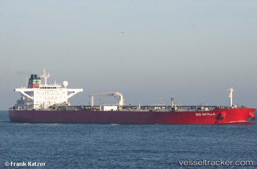
 DENEB
DENEB
Current Status
Where is the vessel?
DENEB is currently in 46 nm SE of CARBONERAS, based on AIS data received about 1h ago.
Latest AIS update:
Current position: 36.27906° N, 1.48552° W (46 nm SE of CARBONERAS)
Average speed (last 7 days): Loading…
Average speed (last 30 days): Loading…
Vessel profile: DENEB is a Crude Oil Tanker with dimensions m x m.
This page combines live AIS, route history, probable destination signals, nearby traffic, and port activity for practical vessel monitoring.
The current position of vessel DENEB is 36.27906 lat / -1.48552 lng. Updated: 2026-05-13 23:32:42 UTCNearest reference points:
- 47 nm SE of CARBONERAS
- 20 nm SE of CARBONERAS
- 45 nm N of Mers El Kebir
Currently sailing under the flag of Sierra Leone ![]()
Details:
Live Vessel DENEB Analytics (details, animations, etc.)
Recent AIS points (UTC):
2026-05-13 19:38:53 UTC · 36.45262, -0.69101 · SOG 9.8 kn · COG 252°2026-05-13 22:07:44 UTC · 36.33833, -1.19667 · SOG 10 kn · COG -1°
2026-05-13 22:13:45 UTC · 36.33333, -1.21667 · SOG 10 kn · COG -1°
2026-05-13 23:32:42 UTC · 36.27906, -1.48552 · SOG 10.1 kn · COG 252°