 vesseltracker.com
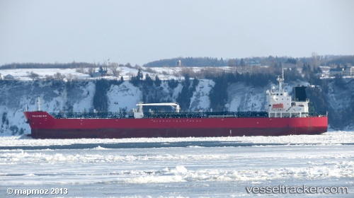
 PANTERA
Current Status
Where is the vessel?
PANTERA is currently in 101 nm NW of Nedroma, based on AIS data received less than 1h ago.
Latest AIS update:
Current position: 35.68200° N, 16.55267° W (101 nm NW of Nedroma)
Average speed (last 7 days): Loading…
Average speed (last 30 days): Loading…
Vessel profile: PANTERA is a Oil/Chemical Tanker with dimensions m x m.
This page combines live AIS, route history, probable destination signals, nearby traffic, and port activity for practical vessel monitoring.
The current position of vessel PANTERA is 35.68200 lat / -16.55267 lng. Updated: 2026-05-14 09:40:03 UTCNearest reference points:
- 78 nm W of Nedroma
Currently sailing under the flag of Bahamas ![]()
Details:
Live Vessel PANTERA Analytics (details, animations, etc.)
Recent AIS points (UTC):
2026-05-14 06:10:48 UTC · 36.35167, -16.07500 · SOG 13 kn · COG -1°2026-05-14 07:01:39 UTC · 36.18500, -16.18833 · SOG 13 kn · COG -1°
2026-05-14 07:14:53 UTC · 36.14317, -16.21867 · SOG 13.4 kn · COG 211°
2026-05-14 09:40:03 UTC · 35.68200, -16.55267 · SOG 13.1 kn · COG 209°