 vesseltracker.com
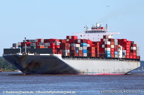
 Humber Bridge
Current Status
Where is the vessel?
Humber Bridge is currently in 81 nm E of Severo-Kurilsk, based on AIS data received about 1h ago.
Latest AIS update:
Current position: 50.54167° N, 158.27499° E (81 nm E of Severo-Kurilsk)
Average speed (last 7 days): Loading…
Average speed (last 30 days): Loading…
Vessel profile: Humber Bridge is a Container Ship with dimensions 336m x 46m.
This page combines live AIS, route history, probable destination signals, nearby traffic, and port activity for practical vessel monitoring.
The current position of vessel Humber Bridge is 50.54167 lat / 158.27499 lng. Updated: 2026-05-13 20:02:04 UTCNearest reference points:
- 31 nm E of Severo-Kurilsk
- Near Severo-Kurilsk
- 13 nm SW of Ozernovskiy
Currently sailing under the flag of Panama ![]()
Humber Bridge built in 2006 year
Deadweight:
98849 tDetails:
Live Vessel Humber Bridge Analytics (details, animations, etc.)
Recent AIS points (UTC):
2026-05-13 16:38:52 UTC · 50.93087, 159.32602 · SOG 13.8 kn · COG 239°2026-05-13 17:43:59 UTC · 50.81167, 158.98167 · SOG 13 kn · COG -1°
2026-05-13 19:29:05 UTC · 50.61030, 158.44119 · SOG 13.6 kn · COG 239°
2026-05-13 20:02:04 UTC · 50.54167, 158.27499 · SOG 13 kn · COG -1°