 vesseltracker.com
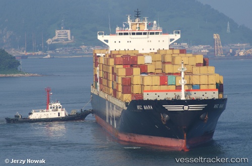
 SC MARA
Current Status
Where is the vessel?
SC MARA is currently in 280 nm S of Tanaga Bay, based on AIS data received less than 1h ago.
Latest AIS update:
Current position: 47.07500° N, 177.87334° W (280 nm S of Tanaga Bay)
Average speed (last 7 days): Loading…
Average speed (last 30 days): Loading…
Vessel profile: SC MARA is a Container Ship with dimensions 294m x 32m.
This page combines live AIS, route history, probable destination signals, nearby traffic, and port activity for practical vessel monitoring.
The current position of vessel SC MARA is 47.07500 lat / -177.87334 lng. Updated: 2026-05-13 22:04:42 UTCNearest reference points:
- Open sea, approx. 418 nm off the nearest listed port
- Open sea, approx. 423 nm off the nearest listed port
- Open sea (no nearby ports in database)
Currently sailing under the flag of Cyprus ![]()
Details:
Live Vessel SC MARA Analytics (details, animations, etc.)
Recent AIS points (UTC):
2026-05-13 19:40:55 UTC · 47.08067, -176.94250 · SOG 15.9 kn · COG 268°2026-05-13 20:13:14 UTC · 47.07482, -177.15234 · SOG 16 kn · COG 270°
2026-05-13 21:35:57 UTC · 47.07637, -177.68878 · SOG 15.9 kn · COG 270°
2026-05-13 22:04:42 UTC · 47.07500, -177.87334 · SOG 15 kn · COG -1°