 vesseltracker.com
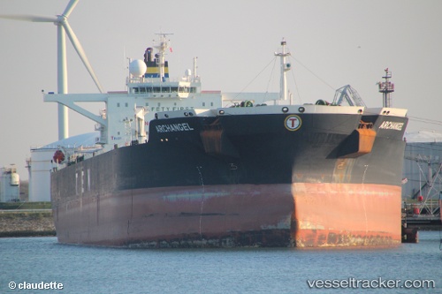
 ARCHANGEL
Current Status
Where is the vessel?
ARCHANGEL is currently in 222 nm E of Belmonte, based on AIS data received less than 1h ago.
Latest AIS update:
Current position: 15.32023° S, 35.09240° W (222 nm E of Belmonte)
Average speed (last 7 days): Loading…
Average speed (last 30 days): Loading…
Vessel profile: ARCHANGEL is a Crude Oil Tanker with dimensions 274m x 274m.
This page combines live AIS, route history, probable destination signals, nearby traffic, and port activity for practical vessel monitoring.
The current position of vessel ARCHANGEL is -15.32023 lat / -35.09240 lng. Updated: 2026-04-28 03:37:43 UTCNearest reference points:
- 169 nm E of Alcobaca
Currently sailing under the flag of Marshall Islands ![]()
ARCHANGEL built in 2006 year
Deadweight:
163216 tDetails:
Live Vessel ARCHANGEL Analytics (details, animations, etc.)
Recent AIS points (UTC):
2026-04-28 00:18:33 UTC · -16.05560, -35.22140 · SOG 13.2 kn · COG 9°2026-04-28 01:37:43 UTC · -15.76553, -35.17105 · SOG 13 kn · COG 12°
2026-04-28 02:00:15 UTC · -15.68182, -35.15498 · SOG 13.5 kn · COG 12°
2026-04-28 03:37:43 UTC · -15.32023, -35.09240 · SOG 13.4 kn · COG 15°