 vesseltracker.com
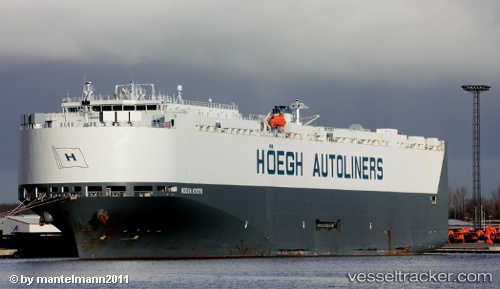
Alliance Fairfax
Current StatusWhere is the vessel?
Alliance Fairfax is currently in 40 nm W of RATNAGIRI, based on AIS data received less than 1h ago.
Latest AIS update:
Current position: 16.84893° N, 72.59370° E (40 nm W of RATNAGIRI)
Average speed (last 7 days): Loading…
Average speed (last 30 days): Loading…
Vessel profile: Alliance Fairfax is a Vehicles Carrier with dimensions 30m x 199m.
This page combines live AIS, route history, probable destination signals, nearby traffic, and port activity for practical vessel monitoring.
The current position of vessel Alliance Fairfax is 16.84893 lat / 72.59370 lng. Updated: 2026-05-14 08:09:39 UTCNearest reference points:
- Near JAIGAD
- 49 nm W of Pernem
- 89 nm W of Marmagao (Marmugao)
Details:
Live Vessel Alliance Fairfax Analytics (details, animations, etc.)
Recent AIS points (UTC):
2026-05-14 04:45:38 UTC · 16.70468, 72.56668 · SOG 13.8 kn · COG 355°2026-05-14 06:02:49 UTC · 16.84925, 72.55197 · SOG 1.1 kn · COG 26°
2026-05-14 07:56:28 UTC · 16.84847, 72.58874 · SOG 1.2 kn · COG 27°
2026-05-14 08:09:39 UTC · 16.84893, 72.59370 · SOG 1.3 kn · COG 27°