 vesseltracker.com
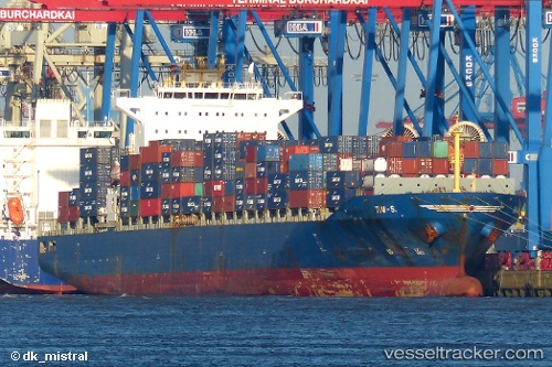
 SM MANALI
Current Status
Where is the vessel?
SM MANALI is currently in Near King Abdullah, based on AIS data received less than 1h ago.
Latest AIS update:
Current position: 22.52595° N, 39.09418° E (Near King Abdullah)
Average speed (last 7 days): Loading…
Average speed (last 30 days): Loading…
Vessel profile: SM MANALI is a Container Ship with dimensions 32m x 222m.
This page combines live AIS, route history, probable destination signals, nearby traffic, and port activity for practical vessel monitoring.
The current position of vessel SM MANALI is 22.52595 lat / 39.09418 lng. Updated: 2026-05-14 13:33:52 UTCNearest reference points:
- Near King Abdullah
- Near Rabigh
- Near King Abdullah City
Currently sailing under the flag of India ![]()
SM MANALI built in 2005 year
Deadweight:
44135 tDetails:
Live Vessel SM MANALI Analytics (details, animations, etc.)
Recent AIS points (UTC):
2026-05-14 09:35:15 UTC · 22.36879, 38.94041 · SOG 6.7 kn · COG 25°2026-05-14 10:02:23 UTC · 22.41486, 38.96565 · SOG 6.8 kn · COG 26°
2026-05-14 12:12:12 UTC · 22.52621, 39.09364 · SOG 0.1 kn · COG 269°
2026-05-14 13:33:52 UTC · 22.52595, 39.09418 · SOG 0.2 kn · COG 269°