 vesseltracker.com
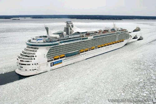
Freedom Of The Seas
Current StatusWhere is the vessel?
Freedom Of The Seas is currently in 44 nm E of ISLA MUJERES, based on AIS data received less than 1h ago.
Latest AIS update:
Current position: 21.30500° N, 85.95500° W (44 nm E of ISLA MUJERES)
Average speed (last 7 days): Loading…
Average speed (last 30 days): Loading…
Vessel profile: Freedom Of The Seas is a Cruise Ship with dimensions 38m x 339m.
This page combines live AIS, route history, probable destination signals, nearby traffic, and port activity for practical vessel monitoring.
The current position of vessel Freedom Of The Seas is 21.30500 lat / -85.95500 lng. Updated: 2026-05-01 04:18:14 UTCNearest reference points:
- Near Puerto Juárez
- 58 nm S of San Julian
Details:
Live Vessel Freedom Of The Seas Analytics (details, animations, etc.)
Recent AIS points (UTC):
2026-05-01 01:54:10 UTC · 20.93333, -86.47167 · SOG 15 kn · COG -1°2026-05-01 02:27:12 UTC · 20.98833, -86.33333 · SOG 16 kn · COG -1°
2026-05-01 04:15:17 UTC · 21.29667, -85.96333 · SOG 16 kn · COG -1°
2026-05-01 04:18:14 UTC · 21.30500, -85.95500 · SOG 16 kn · COG -1°