 vesseltracker.com
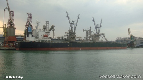
Malakand
Current StatusWhere is the vessel?
Malakand is currently in 124 nm SE of Batonbaton, based on AIS data received less than 1h ago.
Latest AIS update:
Current position: 8.19540° N, 120.17738° E (124 nm SE of Batonbaton)
Average speed (last 7 days): Loading…
Average speed (last 30 days): Loading…
Vessel profile: Malakand is a Bulk Carrier with dimensions 32m x 225m.
This page combines live AIS, route history, probable destination signals, nearby traffic, and port activity for practical vessel monitoring.
The current position of vessel Malakand is 8.19540 lat / 120.17738 lng. Updated: 2026-05-14 22:22:30 UTCNearest reference points:
- 66 nm W of Jolo
- 21 nm NW of Zamboanga
- 35 nm SE of Brookes Point, Palawan
Details:
Live Vessel Malakand Analytics (details, animations, etc.)
Recent AIS points (UTC):
2026-05-14 19:27:49 UTC · 7.67999, 120.10265 · SOG 10.3 kn · COG 8°2026-05-14 19:53:00 UTC · 7.75110, 120.11464 · SOG 10.3 kn · COG 8°
2026-05-14 21:24:59 UTC · 8.02018, 120.15501 · SOG 10.8 kn · COG 10°
2026-05-14 22:22:30 UTC · 8.19540, 120.17738 · SOG 11 kn · COG 12°