 vesseltracker.com
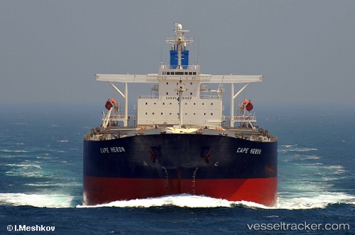
 CAPE HERON
Current Status
Where is the vessel?
CAPE HERON is currently in 19 nm NE of Damietta, based on AIS data received about 166d ago.
Latest AIS update:
Current position: 31.68853° N, 32.05411° E (19 nm NE of Damietta)
Average speed (last 7 days): Loading…
Average speed (last 30 days): Loading…
Vessel profile: CAPE HERON is a Bulk Carrier with dimensions 45m x 289m.
This page combines live AIS, route history, probable destination signals, nearby traffic, and port activity for practical vessel monitoring.
The current position of vessel CAPE HERON is 31.68853 lat / 32.05411 lng. Updated: 2025-11-28 18:33:53 UTCNearest reference points:
- 21 nm N of Port Said
- 15 nm N of Port Said
- 16 nm N of Port Said
Currently sailing under the flag of Liberia ![]()
CAPE HERON built in 2005 year
Deadweight:
177656 tDetails:
Live Vessel CAPE HERON Analytics (details, animations, etc.)
Recent AIS points (UTC):
2025-11-28 18:33:53 UTC · 31.68853, 32.05411 · SOG 10.9 kn · COG 315°