 KARIA
KARIA
Current Status
Where is the vessel?
KARIA is currently in Near Akcansa, based on AIS data received about 15h ago.
Latest AIS update:
Current position: 40.05487° N, 26.26297° E (Near Akcansa)
Average speed (last 7 days): Loading…
Average speed (last 30 days): Loading…
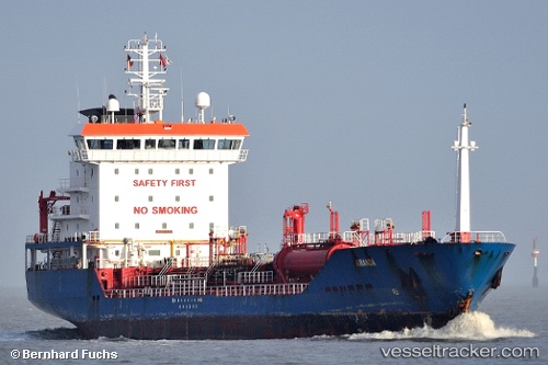
Vessel profile: KARIA is a Chemical/Oil Products Tanker with dimensions 119m x 17m.
This page combines live AIS, route history, probable destination signals, nearby traffic, and port activity for practical vessel monitoring.
The current position of vessel KARIA is 40.05487 lat / 26.26297 lng. Updated: 2026-05-24 07:59:39 UTCNearest reference points:
- 10 nm W of Akcansa
- Near Akcansa
- Near Bozcaada
Currently sailing under the flag of Turkey ![]()
KARIA built in 2005 year
Deadweight:
6954 tDetails:
Live Vessel KARIA Analytics (details, animations, etc.)
Recent AIS points (UTC):
2026-05-24 04:32:48 UTC · 40.45868, 26.81385 · SOG 8.3 kn · COG 246°2026-05-24 05:56:19 UTC · 40.33528, 26.62497 · SOG 11.6 kn · COG 225°
2026-05-24 07:26:40 UTC · 40.13358, 26.37915 · SOG 12.8 kn · COG 228°
2026-05-24 07:59:39 UTC · 40.05487, 26.26297 · SOG 13.4 kn · COG 235°