 vesseltracker.com
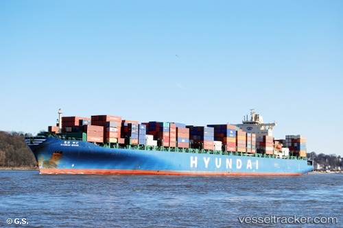
 Hyundai Busan
Current Status
Where is the vessel?
Hyundai Busan is currently in Near Pasir Panjang Wharves, based on AIS data received less than 1h ago.
Latest AIS update:
Current position: 1.26123° N, 103.78948° E (Near Pasir Panjang Wharves)
Average speed (last 7 days): Loading…
Average speed (last 30 days): Loading…
Vessel profile: Hyundai Busan is a Container Ship with dimensions 304m x 40m.
This page combines live AIS, route history, probable destination signals, nearby traffic, and port activity for practical vessel monitoring.
The current position of vessel Hyundai Busan is 1.26123 lat / 103.78948 lng. Updated: 2026-05-15 04:32:27 UTCNearest reference points:
- Near Pasir Panjang Wharves
- Near Bukit Merah Estate
- Near Singapore
Currently sailing under the flag of Cyprus ![]()
Hyundai Busan built in 2006 year
Deadweight:
80102 tDetails:
Live Vessel Hyundai Busan Analytics (details, animations, etc.)
Recent AIS points (UTC):
2026-05-14 22:31:08 UTC · 1.27022, 104.05973 · SOG 8.4 kn · COG 263°2026-05-14 23:45:17 UTC · 1.23367, 103.91770 · SOG 2.5 kn · COG 259°
2026-05-15 04:20:28 UTC · 1.26117, 103.78950 · SOG 0 kn · COG 31°
2026-05-15 04:32:27 UTC · 1.26123, 103.78948 · SOG 0 kn · COG 31°