 vesseltracker.com
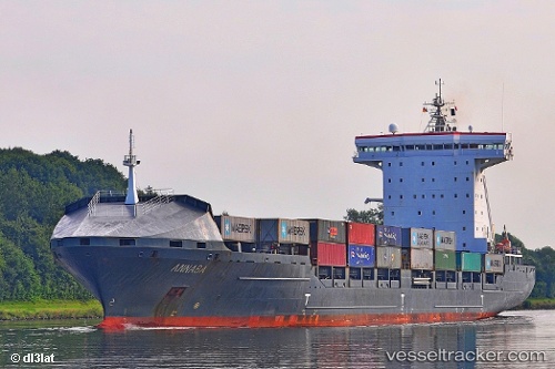
 ANNABA
Current Status
Where is the vessel?
ANNABA is currently in 26 nm E of NOTTNAS, based on AIS data received about 2h ago.
Latest AIS update:
Current position: 59.27407° N, 19.72124° E (26 nm E of NOTTNAS)
Average speed (last 7 days): Loading…
Average speed (last 30 days): Loading…
Vessel profile: ANNABA is a Container Ship with dimensions 167m x 26m.
This page combines live AIS, route history, probable destination signals, nearby traffic, and port activity for practical vessel monitoring.
The current position of vessel ANNABA is 59.27407 lat / 19.72124 lng. Updated: 2026-05-17 23:24:09 UTCNearest reference points:
- Near NOTTNAS
- Near RAVSNAS
- Near GRADDO
Currently sailing under the flag of Portugal (MAR) ![]()
ANNABA built in 2006 year
Deadweight:
20614 tDetails:
Live Vessel ANNABA Analytics (details, animations, etc.)
Recent AIS points (UTC):
2026-05-17 20:09:15 UTC · 58.73983, 18.33466 · SOG 16.3 kn · COG 92°2026-05-17 21:43:15 UTC · 58.96755, 19.02813 · SOG 16.7 kn · COG 50°
2026-05-17 22:43:03 UTC · 59.14875, 19.43809 · SOG 16.7 kn · COG 50°
2026-05-17 23:24:09 UTC · 59.27407, 19.72124 · SOG 16.5 kn · COG 50°