 vesseltracker.com
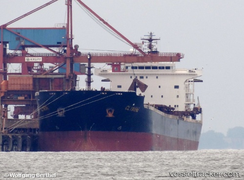
 NANXIN ANGELA
Current Status
Where is the vessel?
NANXIN ANGELA is currently in Near Kozmino Port, based on AIS data received about 7h ago.
Latest AIS update:
Current position: 42.61996° N, 132.98656° E (Near Kozmino Port)
Average speed (last 7 days): Loading…
Average speed (last 30 days): Loading…
Vessel profile: NANXIN ANGELA is a Bulk Carrier with dimensions 32m x 225m.
This page combines live AIS, route history, probable destination signals, nearby traffic, and port activity for practical vessel monitoring.
The current position of vessel NANXIN ANGELA is 42.61996 lat / 132.98656 lng. Updated: 2026-04-27 16:16:50 UTCNearest reference points:
- Near Kozmino Port
- Near KOZMINO
- Near Vostochny
Currently sailing under the flag of Marshall Islands ![]()
NANXIN ANGELA built in 2006 year
Deadweight:
73600 tDetails:
Live Vessel NANXIN ANGELA Analytics (details, animations, etc.)
Recent AIS points (UTC):
2026-04-27 16:16:50 UTC · 42.61996, 132.98656 · SOG 11.4 kn · COG 0°2026-04-27 16:16:50 UTC · 42.61996, 132.98656 · SOG 11.4 kn · COG 0°
2026-04-27 16:16:50 UTC · 42.61996, 132.98656 · SOG 11.4 kn · COG 0°
2026-04-27 16:16:50 UTC · 42.61996, 132.98656 · SOG 11.4 kn · COG 0°