 vesseltracker.com
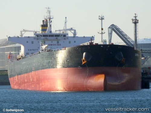
 RYMO
RYMO
Current Status
Where is the vessel?
RYMO is currently in 16 nm S of Stará Voda, based on AIS data received less than 1h ago.
Latest AIS update:
Current position: 54.72909° N, 12.67361° E (16 nm S of Stará Voda)
Average speed (last 7 days): Loading…
Average speed (last 30 days): Loading…
Vessel profile: RYMO is a Crude Oil Tanker with dimensions m x m.
This page combines live AIS, route history, probable destination signals, nearby traffic, and port activity for practical vessel monitoring.
The current position of vessel RYMO is 54.72909 lat / 12.67361 lng. Updated: 2026-04-26 03:21:11 UTCNearest reference points:
- Near Pruchten
- Near Schmedshagen
- Near Rødvig Havn
Currently sailing under the flag of Sierra Leone ![]()
Details:
Live Vessel RYMO Analytics (details, animations, etc.)
Recent AIS points (UTC):
2026-04-26 00:00:17 UTC · 54.40442, 11.98543 · SOG 8.9 kn · COG 88°2026-04-26 00:27:36 UTC · 54.40439, 11.98764 · SOG 8.9 kn · COG 88°
2026-04-26 01:11:55 UTC · 54.40436, 11.99050 · SOG 8.9 kn · COG 88°
2026-04-26 03:21:11 UTC · 54.72909, 12.67361 · SOG 7.9 kn · COG 54°