 vesseltracker.com
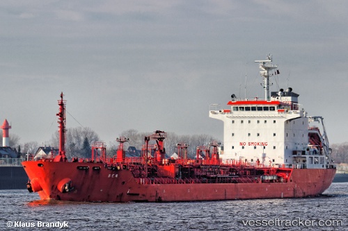
 KARADENIZ POWERSHIP ARYA SULTAN
Current Status
Where is the vessel?
KARADENIZ POWERSHIP ARYA SULTAN is currently in Near Conakry, based on AIS data received about 1h ago.
Latest AIS update:
Current position: 9.51931° N, 13.71522° W (Near Conakry)
Average speed (last 7 days): Loading…
Average speed (last 30 days): Loading…
Vessel profile: KARADENIZ POWERSHIP ARYA SULTAN is a Chemical/Oil Products Tanker with dimensions 20m x 127m.
This page combines live AIS, route history, probable destination signals, nearby traffic, and port activity for practical vessel monitoring.
The current position of vessel KARADENIZ POWERSHIP ARYA SULTAN is 9.51931 lat / -13.71522 lng. Updated: 2026-05-14 11:35:15 UTCNearest reference points:
- Near Conakry
- 28 nm S of Conakry
- 49 nm S of Port de Boké
Currently sailing under the flag of Liberia ![]()
KARADENIZ POWERSHIP ARYA SULTAN built in 2006 year
Deadweight:
12910 tDetails:
Live Vessel KARADENIZ POWERSHIP ARYA SULTAN Analytics (details, animations, etc.)
Recent AIS points (UTC):
2026-05-14 07:20:52 UTC · 9.51833, -13.71500 · SOG 0 kn · COG -1°2026-05-14 09:38:18 UTC · 9.51930, -13.71525 · SOG 0 kn · COG 162°
2026-05-14 10:35:16 UTC · 9.51929, -13.71524 · SOG 0 kn · COG 162°
2026-05-14 11:35:15 UTC · 9.51931, -13.71522 · SOG 0 kn · COG 162°