 vesseltracker.com
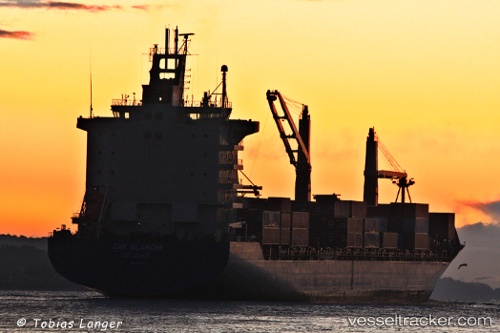
As Carlotta
Current StatusWhere is the vessel?
As Carlotta is currently in 43 nm S of Aki, Kochi, based on AIS data received less than 1h ago.
Latest AIS update:
Current position: 32.80833° N, 134.12167° E (43 nm S of Aki, Kochi)
Average speed (last 7 days): Loading…
Average speed (last 30 days): Loading…
Vessel profile: As Carlotta is a Container Ship with dimensions 28m x 222m.
This page combines live AIS, route history, probable destination signals, nearby traffic, and port activity for practical vessel monitoring.
The current position of vessel As Carlotta is 32.80833 lat / 134.12167 lng. Updated: 2026-05-16 10:40:41 UTCNearest reference points:
- Near Kochi
- 40 nm SW of Minachi
- Near TOKUSHIMA
Details:
Live Vessel As Carlotta Analytics (details, animations, etc.)
Recent AIS points (UTC):
2026-05-16 07:10:42 UTC · 33.01333, 135.04167 · SOG 14 kn · COG -1°2026-05-16 07:40:42 UTC · 32.98333, 134.90668 · SOG 14 kn · COG -1°
2026-05-16 09:25:45 UTC · 32.88667, 134.43832 · SOG 13 kn · COG -1°
2026-05-16 10:40:41 UTC · 32.80833, 134.12167 · SOG 13 kn · COG -1°