 vesseltracker.com
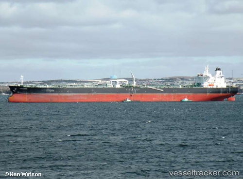
 EXPLORER
Current Status
Where is the vessel?
EXPLORER is currently in Near Ima, based on AIS data received less than 1h ago.
Latest AIS update:
Current position: 4.20968° N, 7.46133° E (Near Ima)
Average speed (last 7 days): Loading…
Average speed (last 30 days): Loading…
Vessel profile: EXPLORER is a Crude Oil Tanker with dimensions 50m x 274m.
This page combines live AIS, route history, probable destination signals, nearby traffic, and port activity for practical vessel monitoring.
The current position of vessel EXPLORER is 4.20968 lat / 7.46133 lng. Updated: 2026-05-14 21:57:08 UTCNearest reference points:
- Near Ima
- Near Odudu Terminal
- 12 nm SE of Okono
Currently sailing under the flag of Liberia ![]()
EXPLORER built in 2006 year
Deadweight:
163759 tDetails:
Live Vessel EXPLORER Analytics (details, animations, etc.)
Recent AIS points (UTC):
2026-05-14 17:21:36 UTC · 4.20860, 7.46312 · SOG 0.3 kn · COG 257°2026-05-14 19:39:34 UTC · 4.20682, 7.46243 · SOG 0.1 kn · COG 291°
2026-05-14 20:01:52 UTC · 4.20787, 7.46283 · SOG 0.2 kn · COG 266°
2026-05-14 21:57:08 UTC · 4.20968, 7.46133 · SOG 0.1 kn · COG 186°