 vesseltracker.com
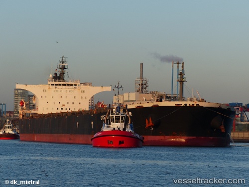
 Aquakatie
Current Status
Where is the vessel?
Aquakatie is currently in 55 nm NE of Karkar Is, based on AIS data received less than 1h ago.
Latest AIS update:
Current position: 4.23520° S, 146.79697° E (55 nm NE of Karkar Is)
Average speed (last 7 days): Loading…
Average speed (last 30 days): Loading…
Vessel profile: Aquakatie is a Bulk Carrier with dimensions 289m x 45m.
This page combines live AIS, route history, probable destination signals, nearby traffic, and port activity for practical vessel monitoring.
The current position of vessel Aquakatie is -4.23520 lat / 146.79697 lng. Updated: 2026-05-14 11:41:26 UTCNearest reference points:
- Near Lae
- 42 nm E of Tami Island
Currently sailing under the flag of Liberia ![]()
Aquakatie built in 2007 year
Deadweight:
174142 tDetails:
Live Vessel Aquakatie Analytics (details, animations, etc.)
Recent AIS points (UTC):
2026-05-14 07:37:53 UTC · -3.54255, 146.41096 · SOG 11.9 kn · COG 145°2026-05-14 09:37:32 UTC · -3.88918, 146.60374 · SOG 11.9 kn · COG 146°
2026-05-14 10:23:23 UTC · -4.01782, 146.67770 · SOG 11.4 kn · COG 147°
2026-05-14 11:41:26 UTC · -4.23520, 146.79697 · SOG 11.3 kn · COG 149°