 vesseltracker.com
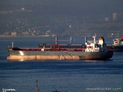
 MOSTAR
Current Status
Where is the vessel?
MOSTAR is currently in 370 nm NW of River Sao Nicolau, based on AIS data received less than 1h ago.
Latest AIS update:
Current position: 11.60551° S, 6.61388° E (370 nm NW of River Sao Nicolau)
Average speed (last 7 days): Loading…
Average speed (last 30 days): Loading…
Vessel profile: MOSTAR is a Oil/Chemical Tanker with dimensions m x m.
This page combines live AIS, route history, probable destination signals, nearby traffic, and port activity for practical vessel monitoring.
The current position of vessel MOSTAR is -11.60551 lat / 6.61388 lng. Updated: 2026-05-02 12:01:57 UTCNearest reference points:
- Open sea, approx. 400 nm off the nearest listed port
- Open sea, approx. 402 nm off the nearest listed port
- Open sea, approx. 401 nm off the nearest listed port
Currently sailing under the flag of Panama ![]()
Details:
Live Vessel MOSTAR Analytics (details, animations, etc.)
Recent AIS points (UTC):
2026-05-02 07:48:00 UTC · -10.82367, 6.29446 · SOG 12.2 kn · COG 157°2026-05-02 09:26:13 UTC · -11.12557, 6.41689 · SOG 12.1 kn · COG 161°
2026-05-02 10:30:57 UTC · -11.32309, 6.50139 · SOG 12.1 kn · COG 160°
2026-05-02 12:01:57 UTC · -11.60551, 6.61388 · SOG 11.6 kn · COG 160°