 vesseltracker.com
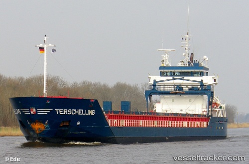
 Terschelling
Current Status
Where is the vessel?
Terschelling is currently in Near Nieuwdorp, based on AIS data received less than 1h ago.
Latest AIS update:
Current position: 51.45789° N, 3.67550° E (Near Nieuwdorp)
Average speed (last 7 days): Loading…
Average speed (last 30 days): Loading…
Vessel profile: Terschelling is a Multi Purpose Carrier with dimensions 111m x 111m.
This page combines live AIS, route history, probable destination signals, nearby traffic, and port activity for practical vessel monitoring.
The current position of vessel Terschelling is 51.45789 lat / 3.67550 lng. Updated: 2026-05-14 23:58:56 UTCNearest reference points:
- Near Nieuwdorp
- Near Borssele
- Near BASTIAAN DE LANGEPLA
Currently sailing under the flag of Netherlands ![]()
Terschelling built in 2005 year
Deadweight:
6000 tDetails:
Live Vessel Terschelling Analytics (details, animations, etc.)
Recent AIS points (UTC):
2026-05-14 20:02:35 UTC · 51.45790, 3.67549 · SOG 0 kn · COG 333°2026-05-14 21:59:10 UTC · 51.45788, 3.67551 · SOG 0 kn · COG 333°
2026-05-14 22:35:38 UTC · 51.45789, 3.67549 · SOG 0 kn · COG 333°
2026-05-14 23:58:56 UTC · 51.45789, 3.67550 · SOG 0 kn · COG 333°