 vesseltracker.com
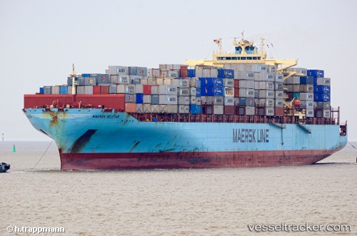
 Maersk Seletar
Current Status
Where is the vessel?
Maersk Seletar is currently in 165 nm W of Saldanha Bay, based on AIS data received less than 1h ago.
Latest AIS update:
Current position: 32.39029° S, 14.71639° E (165 nm W of Saldanha Bay)
Average speed (last 7 days): Loading…
Average speed (last 30 days): Loading…
Vessel profile: Maersk Seletar is a Container Ship with dimensions 319m x 40m.
This page combines live AIS, route history, probable destination signals, nearby traffic, and port activity for practical vessel monitoring.
The current position of vessel Maersk Seletar is -32.39029 lat / 14.71639 lng. Updated: 2026-05-02 18:16:19 UTCNearest reference points:
- 167 nm SW of Koiingnaas
- 154 nm W of Koiingnaas
- 116 nm SW of Saldanha Bay
Currently sailing under the flag of USA ![]()
Maersk Seletar built in 2007 year
Deadweight:
85250 tDetails:
Live Vessel Maersk Seletar Analytics (details, animations, etc.)
Recent AIS points (UTC):
2026-05-02 13:34:55 UTC · -33.30678, 16.13343 · SOG 19.7 kn · COG 304°2026-05-02 16:07:16 UTC · -32.80779, 15.36401 · SOG 19.1 kn · COG 309°
2026-05-02 16:27:04 UTC · -32.74212, 15.26453 · SOG 19.3 kn · COG 308°
2026-05-02 18:16:19 UTC · -32.39029, 14.71639 · SOG 18.9 kn · COG 308°