 vesseltracker.com
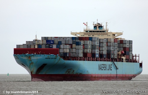
 Maersk Sentosa
Current Status
Where is the vessel?
Maersk Sentosa is currently in 165 nm NW of Yof, based on AIS data received about 1h ago.
Latest AIS update:
Current position: 16.77450° N, 19.40650° W (165 nm NW of Yof)
Average speed (last 7 days): Loading…
Average speed (last 30 days): Loading…
Vessel profile: Maersk Sentosa is a Container Ship with dimensions 319m x 318m.
This page combines live AIS, route history, probable destination signals, nearby traffic, and port activity for practical vessel monitoring.
The current position of vessel Maersk Sentosa is 16.77450 lat / -19.40650 lng. Updated: 2026-05-02 14:11:40 UTCNearest reference points:
- 100 nm NW of Saint Louis
- 119 nm W of Nouakchott
- 90 nm W of Nouakchott
Currently sailing under the flag of USA ![]()
Maersk Sentosa built in 2007 year
Deadweight:
85250 tDetails:
Live Vessel Maersk Sentosa Analytics (details, animations, etc.)
Recent AIS points (UTC):
2026-05-02 10:14:22 UTC · 17.92951, -19.41463 · SOG 18.2 kn · COG 178°2026-05-02 11:46:04 UTC · 17.47630, -19.41048 · SOG 17.6 kn · COG 177°
2026-05-02 13:38:58 UTC · 16.93149, -19.40981 · SOG 17.4 kn · COG 176°
2026-05-02 14:11:40 UTC · 16.77450, -19.40650 · SOG 17.2 kn · COG 176°