 vesseltracker.com
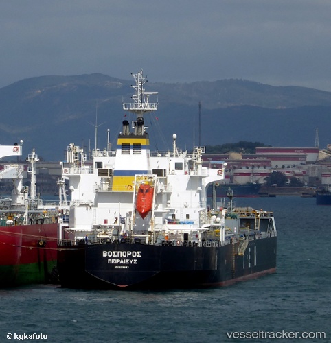
 BOSPOROS
Current Status
Where is the vessel?
BOSPOROS is currently in Near Fredericia, based on AIS data received less than 1h ago.
Latest AIS update:
Current position: 55.55551° N, 9.76622° E (Near Fredericia)
Average speed (last 7 days): Loading…
Average speed (last 30 days): Loading…
Vessel profile: BOSPOROS is a Chemical/Oil Products Tanker with dimensions 27m x 182m.
This page combines live AIS, route history, probable destination signals, nearby traffic, and port activity for practical vessel monitoring.
The current position of vessel BOSPOROS is 55.55551 lat / 9.76622 lng. Updated: 2026-05-15 10:13:27 UTCNearest reference points:
- Near Kolding
- Near Horsens
- Near Sonderborg
Currently sailing under the flag of Marshall Islands ![]()
BOSPOROS built in 2007 year
Deadweight:
39589 tDetails:
Live Vessel BOSPOROS Analytics (details, animations, etc.)
Recent AIS points (UTC):
2026-05-15 07:07:27 UTC · 55.55550, 9.76623 · SOG 0 kn · COG 293°2026-05-15 07:37:27 UTC · 55.55548, 9.76624 · SOG 0 kn · COG 293°
2026-05-15 10:01:27 UTC · 55.55551, 9.76621 · SOG 0 kn · COG 293°
2026-05-15 10:13:27 UTC · 55.55551, 9.76622 · SOG 0 kn · COG 293°