 vesseltracker.com
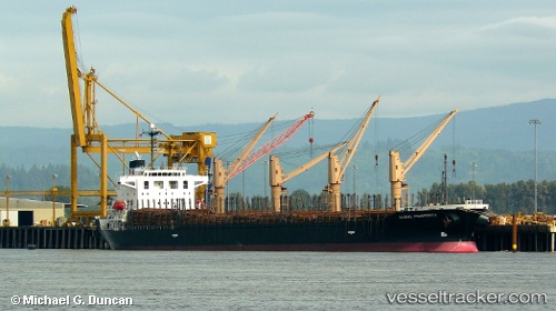
Hai Nam 87
Current StatusWhere is the vessel?
Hai Nam 87 is currently in 27 nm SW of RATNAGIRI, based on AIS data received less than 1h ago.
Latest AIS update:
Current position: 16.66963° N, 72.96192° E (27 nm SW of RATNAGIRI)
Average speed (last 7 days): Loading…
Average speed (last 30 days): Loading…
Vessel profile: Hai Nam 87 is a Bulk Carrier with dimensions 28m x 175m.
This page combines live AIS, route history, probable destination signals, nearby traffic, and port activity for practical vessel monitoring.
The current position of vessel Hai Nam 87 is 16.66963 lat / 72.96192 lng. Updated: 2026-05-02 22:59:13 UTCNearest reference points:
- Near JAIGAD
- 49 nm W of Pernem
- Near Vasco da Gama
Details:
Live Vessel Hai Nam 87 Analytics (details, animations, etc.)
Recent AIS points (UTC):
2026-05-02 19:05:43 UTC · 17.44320, 72.74780 · SOG 12.2 kn · COG 167°2026-05-02 19:41:42 UTC · 17.32533, 72.78153 · SOG 12.5 kn · COG 168°
2026-05-02 22:02:42 UTC · 16.85552, 72.90638 · SOG 12.3 kn · COG 169°
2026-05-02 22:59:13 UTC · 16.66963, 72.96192 · SOG 12.2 kn · COG 166°