 vesseltracker.com
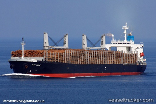
 Astoria Bay
Current Status
Where is the vessel?
Astoria Bay is currently in Near Prince Rupert, based on AIS data received less than 1h ago.
Latest AIS update:
Current position: 54.35478° N, 130.27335° W (Near Prince Rupert)
Average speed (last 7 days): Loading…
Average speed (last 30 days): Loading…
Vessel profile: Astoria Bay is a Bulk Carrier with dimensions 185m x 30m.
This page combines live AIS, route history, probable destination signals, nearby traffic, and port activity for practical vessel monitoring.
The current position of vessel Astoria Bay is 54.35478 lat / -130.27335 lng. Updated: 2026-05-15 10:13:26 UTCNearest reference points:
- Near Prince Rupert
- Near Watson Island
- 11 nm S of Kitimat
Currently sailing under the flag of Hong Kong ![]()
Astoria Bay built in 2005 year
Deadweight:
46619 tDetails:
Live Vessel Astoria Bay Analytics (details, animations, etc.)
Recent AIS points (UTC):
2026-05-15 07:19:29 UTC · 54.35130, -130.27541 · SOG 0 kn · COG 15°2026-05-15 07:58:26 UTC · 54.35134, -130.27490 · SOG 0 kn · COG 6°
2026-05-15 10:07:29 UTC · 54.35483, -130.27341 · SOG 0 kn · COG 201°
2026-05-15 10:13:26 UTC · 54.35478, -130.27335 · SOG 0 kn · COG 205°