 vesseltracker.com
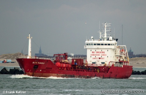
 DEE FISHER
Current Status
Where is the vessel?
DEE FISHER is currently in 18 nm NW of Hunsdon, based on AIS data received less than 1h ago.
Latest AIS update:
Current position: 52.01051° N, 2.92115° E (18 nm NW of Hunsdon)
Average speed (last 7 days): Loading…
Average speed (last 30 days): Loading…
Vessel profile: DEE FISHER is a Chemical/Oil Products Tanker with dimensions 100m x 15m.
This page combines live AIS, route history, probable destination signals, nearby traffic, and port activity for practical vessel monitoring.
The current position of vessel DEE FISHER is 52.01051 lat / 2.92115 lng. Updated: 2026-05-15 03:59:13 UTCNearest reference points:
- Near Hunsdon
- 21 nm S of Craven Arms
- Near Thorntonbank
Currently sailing under the flag of Cyprus ![]()
DEE FISHER built in 2006 year
Deadweight:
4653 tDetails:
Live Vessel DEE FISHER Analytics (details, animations, etc.)
Recent AIS points (UTC):
2026-05-14 22:37:23 UTC · 51.42648, 2.10790 · SOG 8.1 kn · COG 40°2026-05-14 23:58:53 UTC · 51.56681, 2.31376 · SOG 8.3 kn · COG 40°
2026-05-15 01:15:54 UTC · 51.70020, 2.49274 · SOG 7.8 kn · COG 40°
2026-05-15 03:59:13 UTC · 52.01051, 2.92115 · SOG 10.2 kn · COG 46°