 vesseltracker.com
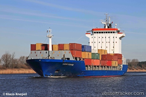
 Elke
Elke
Current Status
Where is the vessel?
Elke is currently in Near Kellenhusen, based on AIS data received less than 1h ago.
Latest AIS update:
Current position: 54.10802° N, 11.17242° E (Near Kellenhusen)
Average speed (last 7 days): Loading…
Average speed (last 30 days): Loading…
Vessel profile: Elke is a Container Ship with dimensions 140m x 22m.
This page combines live AIS, route history, probable destination signals, nearby traffic, and port activity for practical vessel monitoring.
The current position of vessel Elke is 54.10802 lat / 11.17242 lng. Updated: 2026-04-30 15:47:21 UTCNearest reference points:
- Near Grossenbrode
- Near BURGSTAAKEN
- Near Wismar
Currently sailing under the flag of Cyprus ![]()
Elke built in 2005 year
Deadweight:
11023 tDetails:
Live Vessel Elke Analytics (details, animations, etc.)
Recent AIS points (UTC):
2026-04-30 11:50:13 UTC · 53.90337, 10.77113 · SOG 0 kn · COG 312°2026-04-30 13:38:34 UTC · 53.90148, 10.77262 · SOG 3.7 kn · COG 132°
2026-04-30 13:56:23 UTC · 53.89454, 10.80556 · SOG 5.2 kn · COG 91°
2026-04-30 15:47:21 UTC · 54.10802, 11.17242 · SOG 14.7 kn · COG 50°