 vesseltracker.com
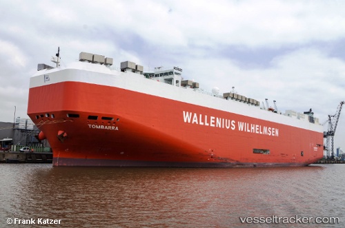
 Tombarra
Current Status
Where is the vessel?
Tombarra is currently in 70 nm SW of Bodega Bay, based on AIS data received less than 1h ago.
Latest AIS update:
Current position: 37.74307° N, 124.32405° W (70 nm SW of Bodega Bay)
Average speed (last 7 days): Loading…
Average speed (last 30 days): Loading…
Vessel profile: Tombarra is a Vehicles Carrier with dimensions 199m x 32m.
This page combines live AIS, route history, probable destination signals, nearby traffic, and port activity for practical vessel monitoring.
The current position of vessel Tombarra is 37.74307 lat / -124.32405 lng. Updated: 2026-05-14 07:29:58 UTCNearest reference points:
- Near Bodega Bay
- Near Little River
- Near San Anselmo
Currently sailing under the flag of Malta ![]()
Tombarra built in 2006 year
Deadweight:
22149 tDetails:
Live Vessel Tombarra Analytics (details, animations, etc.)
Recent AIS points (UTC):
2026-05-14 05:00:16 UTC · 37.13372, -124.05271 · SOG 15.3 kn · COG 338°2026-05-14 06:04:58 UTC · 37.39640, -124.16831 · SOG 15.5 kn · COG 341°
2026-05-14 07:16:34 UTC · 37.68966, -124.29806 · SOG 15.2 kn · COG 338°
2026-05-14 07:29:58 UTC · 37.74307, -124.32405 · SOG 15.7 kn · COG 338°