 vesseltracker.com
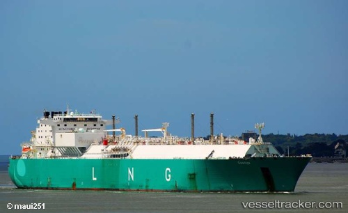
 Lng Alliance
Current Status
Where is the vessel?
Lng Alliance is currently in 18 nm W of Abu Zenimah, based on AIS data received about 1229d ago.
Latest AIS update:
Current position: 29.10403° N, 32.76159° E (18 nm W of Abu Zenimah)
Average speed (last 7 days): Loading…
Average speed (last 30 days): Loading…
Vessel profile: Lng Alliance is a Lng Tanker with dimensions 290m x 43m.
This page combines live AIS, route history, probable destination signals, nearby traffic, and port activity for practical vessel monitoring.
The current position of vessel Lng Alliance is 29.10403 lat / 32.76159 lng. Updated: 2022-12-31 19:35:25 UTCNearest reference points:
- Near Ras Sudr
- Near Al Adabiyah
- Near Bur Ibrahim
Currently sailing under the flag of France ![]()
Lng Alliance built in 2007 year
Deadweight:
74300 tDetails:
Live Vessel Lng Alliance Analytics (details, animations, etc.)
Recent AIS points (UTC):
2022-12-31 19:35:25 UTC · 29.10403, 32.76159 · SOG 12.2 kn · COG 160°