 vesseltracker.com
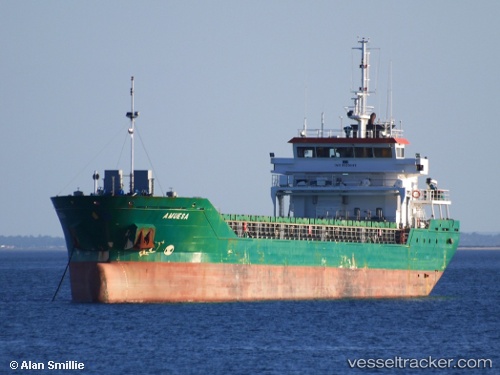
 Amuesa
Current Status
Where is the vessel?
Amuesa is currently in Near San Juan de Nieva, based on AIS data received about 1h ago.
Latest AIS update:
Current position: 43.57246° N, 5.91965° W (Near San Juan de Nieva)
Average speed (last 7 days): Loading…
Average speed (last 30 days): Loading…
Vessel profile: Amuesa is a General Cargo Ship with dimensions 87m x 15m.
This page combines live AIS, route history, probable destination signals, nearby traffic, and port activity for practical vessel monitoring.
The current position of vessel Amuesa is 43.57246 lat / -5.91965 lng. Updated: 2026-05-14 16:34:33 UTCNearest reference points:
- Near San Juan de Nieva
- Near Musel-Arnao
- Near Tremanes
Currently sailing under the flag of Portugal ![]()
Amuesa built in 2007 year
Deadweight:
5045 tDetails:
Live Vessel Amuesa Analytics (details, animations, etc.)
Recent AIS points (UTC):
2026-05-14 13:37:36 UTC · 43.57249, -5.91963 · SOG 0 kn · COG 355°2026-05-14 14:07:35 UTC · 43.57244, -5.91966 · SOG 0 kn · COG 355°
2026-05-14 15:37:35 UTC · 43.57248, -5.91962 · SOG 0 kn · COG 355°
2026-05-14 16:34:33 UTC · 43.57246, -5.91965 · SOG 0 kn · COG 355°