 vesseltracker.com
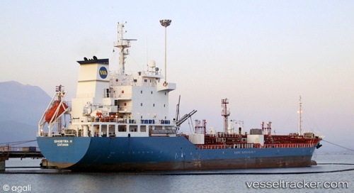
 GIOIA MIA
Current Status
Where is the vessel?
GIOIA MIA is currently in 57 nm NW of Bartin, based on AIS data received less than 1h ago.
Latest AIS update:
Current position: 42.42369° N, 31.44478° E (57 nm NW of Bartin)
Average speed (last 7 days): Loading…
Average speed (last 30 days): Loading…
Vessel profile: GIOIA MIA is a Oil/Chemical Tanker with dimensions m x m.
This page combines live AIS, route history, probable destination signals, nearby traffic, and port activity for practical vessel monitoring.
The current position of vessel GIOIA MIA is 42.42369 lat / 31.44478 lng. Updated: 2026-05-17 12:10:16 UTCNearest reference points:
- Near Erdemir
- Near Cide
- 27 nm NW of INEBOLU
Currently sailing under the flag of Palau ![]()
Details:
Live Vessel GIOIA MIA Analytics (details, animations, etc.)
Recent AIS points (UTC):
2026-05-17 07:44:06 UTC · 42.70145, 30.78860 · SOG 8.4 kn · COG 141°2026-05-17 09:25:16 UTC · 42.51205, 30.97300 · SOG 8.5 kn · COG 150°
2026-05-17 10:14:05 UTC · 42.42636, 31.07119 · SOG 8.4 kn · COG 124°
2026-05-17 12:10:16 UTC · 42.42369, 31.44478 · SOG 8.8 kn · COG 80°