 vesseltracker.com
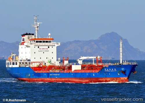
 EMMA
EMMA
Current Status
Where is the vessel?
EMMA is currently in 14 nm W of Abu Zenimah, based on AIS data received less than 1h ago.
Latest AIS update:
Current position: 29.06991° N, 32.83295° E (14 nm W of Abu Zenimah)
Average speed (last 7 days): Loading…
Average speed (last 30 days): Loading…
Vessel profile: EMMA is a Tanker with dimensions m x m.
This page combines live AIS, route history, probable destination signals, nearby traffic, and port activity for practical vessel monitoring.
The current position of vessel EMMA is 29.06991 lat / 32.83295 lng. Updated: 2026-05-01 22:19:57 UTCNearest reference points:
- Near Ras Sudr
- Near Al Adabiyah
- Near Ras Gharib
Details:
Live Vessel EMMA Analytics (details, animations, etc.)
Recent AIS points (UTC):
2026-05-01 19:09:05 UTC · 28.72484, 32.99876 · SOG 7.3 kn · COG 334°2026-05-01 19:58:12 UTC · 28.81500, 32.95667 · SOG 6 kn · COG -1°
2026-05-01 22:03:24 UTC · 29.04025, 32.84689 · SOG 7 kn · COG 338°
2026-05-01 22:19:57 UTC · 29.06991, 32.83295 · SOG 7 kn · COG 340°