 vesseltracker.com
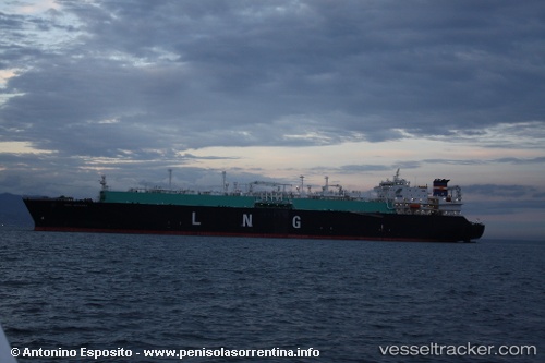
 Seri Angkasa
Current Status
Where is the vessel?
Seri Angkasa is currently in 101 nm N of TANJUNG JATI, based on AIS data received less than 1h ago.
Latest AIS update:
Current position: 4.82239° S, 111.21116° E (101 nm N of TANJUNG JATI)
Average speed (last 7 days): Loading…
Average speed (last 30 days): Loading…
Vessel profile: Seri Angkasa is a Lng Tanker with dimensions 282m x 284m.
This page combines live AIS, route history, probable destination signals, nearby traffic, and port activity for practical vessel monitoring.
The current position of vessel Seri Angkasa is -4.82239 lat / 111.21116 lng. Updated: 2026-05-14 05:27:18 UTCNearest reference points:
- 68 nm NW of Gagak Rimang Fso
- 49 nm NE of TANJUNG JATI
- 60 nm NW of Camar Marine Terminal
Currently sailing under the flag of Malaysia ![]()
Seri Angkasa built in 2006 year
Deadweight:
83407 tDetails:
Live Vessel Seri Angkasa Analytics (details, animations, etc.)
Recent AIS points (UTC):
2026-05-14 01:33:37 UTC · -4.51258, 110.33790 · SOG 14.5 kn · COG 110°2026-05-14 03:48:43 UTC · -4.70588, 110.84602 · SOG 14.4 kn · COG 108°
2026-05-14 04:52:07 UTC · -4.78132, 111.08165 · SOG 13.6 kn · COG 108°
2026-05-14 05:27:18 UTC · -4.82239, 111.21116 · SOG 13.8 kn · COG 108°