 vesseltracker.com
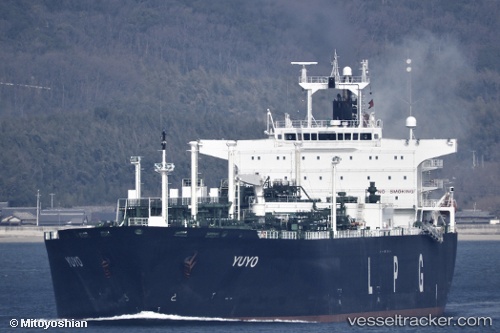
Yuyo
Current StatusWhere is the vessel?
Yuyo is currently in Open sea (no nearby ports in database), based on AIS data received about 1h ago.
Latest AIS update:
Current position: 4.24017° S, 81.94040° E (Open sea (no nearby ports in database))
Average speed (last 7 days): Loading…
Average speed (last 30 days): Loading…
Vessel profile: Yuyo is a Lpg Tanker with dimensions 37m x 230m.
This page combines live AIS, route history, probable destination signals, nearby traffic, and port activity for practical vessel monitoring.
The current position of vessel Yuyo is -4.24017 lat / 81.94040 lng. Updated: 2026-04-25 01:47:23 UTCNearest reference points:
- Open sea (no nearby ports in database)
Details:
Live Vessel Yuyo Analytics (details, animations, etc.)
Recent AIS points (UTC):
2026-04-24 22:00:55 UTC · -4.81333, 81.24590 · SOG 14.7 kn · COG 53°2026-04-24 23:55:02 UTC · -4.52249, 81.60006 · SOG 14.4 kn · COG 50°
2026-04-25 01:47:23 UTC · -4.24017, 81.94040 · SOG 13.9 kn · COG 54°
2026-04-25 01:47:23 UTC · -4.24017, 81.94040 · SOG 13.9 kn · COG 54°