 vesseltracker.com
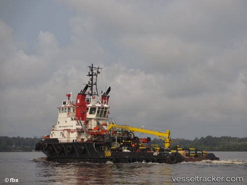
 ADVANTIS LIBRA
Current Status
Where is the vessel?
ADVANTIS LIBRA is currently in 10 nm NW of Cox's Bazar, based on AIS data received less than 1h ago.
Latest AIS update:
Current position: 21.52755° N, 91.82833° E (10 nm NW of Cox's Bazar)
Average speed (last 7 days): Loading…
Average speed (last 30 days): Loading…
Vessel profile: ADVANTIS LIBRA is a Tug with dimensions m x m.
This page combines live AIS, route history, probable destination signals, nearby traffic, and port activity for practical vessel monitoring.
The current position of vessel ADVANTIS LIBRA is 21.52755 lat / 91.82833 lng. Updated: 2026-05-14 07:58:24 UTCNearest reference points:
- 23 nm NW of Cox's Bazar
- Near Chittagong
- 36 nm SE of Cox's Bazar
Currently sailing under the flag of Saint Vincent and the Grenadines ![]()
Details:
Live Vessel ADVANTIS LIBRA Analytics (details, animations, etc.)
Recent AIS points (UTC):
2026-05-14 04:40:26 UTC · 21.52877, 91.82874 · SOG 0.2 kn · COG 19°2026-05-14 05:44:11 UTC · 21.52765, 91.82892 · SOG 0.1 kn · COG 355°
2026-05-14 07:18:21 UTC · 21.52754, 91.82837 · SOG 0.1 kn · COG 356°
2026-05-14 07:58:24 UTC · 21.52755, 91.82833 · SOG 0.1 kn · COG 351°