 vesseltracker.com
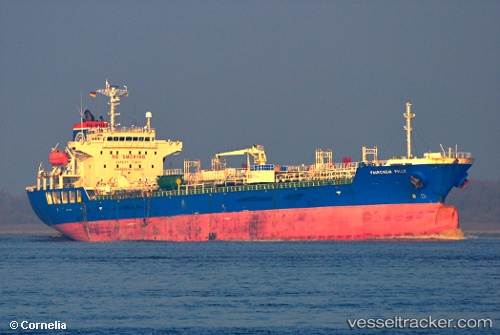
 Lavraki
Current Status
Where is the vessel?
Lavraki is currently in Near Montréal-Est, based on AIS data received about 1h ago.
Latest AIS update:
Current position: 45.63132° N, 73.49166° W (Near Montréal-Est)
Average speed (last 7 days): Loading…
Average speed (last 30 days): Loading…
Vessel profile: Lavraki is a Chemical Oil Products Tanker with dimensions 146m x 24m.
This page combines live AIS, route history, probable destination signals, nearby traffic, and port activity for practical vessel monitoring.
The current position of vessel Lavraki is 45.63132 lat / -73.49166 lng. Updated: 2026-05-14 06:20:14 UTCNearest reference points:
- Near Montréal-Est
- Near Longueuil
- Near Montreal
Currently sailing under the flag of Marshall Is ![]()
Lavraki built in 2007 year
Deadweight:
20810 tDetails:
Live Vessel Lavraki Analytics (details, animations, etc.)
Recent AIS points (UTC):
2026-05-14 01:50:12 UTC · 45.63130, -73.49165 · SOG 0 kn · COG 216°2026-05-14 03:32:10 UTC · 45.63136, -73.49165 · SOG 0 kn · COG 216°
2026-05-14 03:32:10 UTC · 45.63136, -73.49165 · SOG 0 kn · COG 216°
2026-05-14 06:20:14 UTC · 45.63132, -73.49166 · SOG 0 kn · COG 216°