 vesseltracker.com
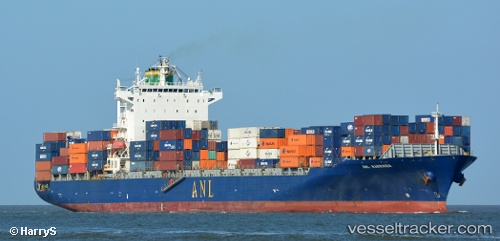
 Navios Vermilion
Current Status
Where is the vessel?
Navios Vermilion is currently in 28 nm NE of Craven Arms, based on AIS data received about 2h ago.
Latest AIS update:
Current position: 52.64489° N, 3.52400° E (28 nm NE of Craven Arms)
Average speed (last 7 days): Loading…
Average speed (last 30 days): Loading…
Vessel profile: Navios Vermilion is a Container Ship with dimensions 260m x 32m.
This page combines live AIS, route history, probable destination signals, nearby traffic, and port activity for practical vessel monitoring.
The current position of vessel Navios Vermilion is 52.64489 lat / 3.52400 lng. Updated: 2026-05-15 01:13:59 UTCNearest reference points:
- 23 nm N of de Ruyter
- 22 nm W of Schoorl
- Near de Ruyter
Currently sailing under the flag of Marshall Is ![]()
Navios Vermilion built in 2007 year
Deadweight:
50629 tDetails:
Live Vessel Navios Vermilion Analytics (details, animations, etc.)
Recent AIS points (UTC):
2026-05-14 21:48:50 UTC · 53.01736, 4.09592 · SOG 10.2 kn · COG 229°2026-05-14 22:23:12 UTC · 52.95379, 3.97580 · SOG 9.9 kn · COG 229°
2026-05-14 23:58:00 UTC · 52.77523, 3.70561 · SOG 8.4 kn · COG 219°
2026-05-15 01:13:59 UTC · 52.64489, 3.52400 · SOG 7.9 kn · COG 222°