 vesseltracker.com
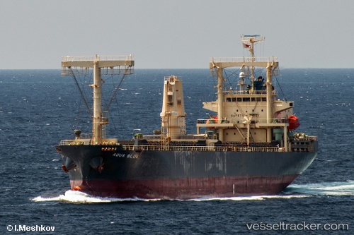
 Aqua Blue
Current Status
Where is the vessel?
Aqua Blue is currently in 39 nm W of Serdang, based on AIS data received about 1h ago.
Latest AIS update:
Current position: 2.75667° S, 105.80500° E (39 nm W of Serdang)
Average speed (last 7 days): Loading…
Average speed (last 30 days): Loading…
Vessel profile: Aqua Blue is a General Cargo Ship with dimensions 125m x 21m.
This page combines live AIS, route history, probable destination signals, nearby traffic, and port activity for practical vessel monitoring.
The current position of vessel Aqua Blue is -2.75667 lat / 105.80500 lng. Updated: 2026-05-14 12:19:19 UTCNearest reference points:
- 38 nm SW of PANGKAL BALAM
- Near PANGKAL BALAM
- 36 nm SW of Exspan
Currently sailing under the flag of Panama ![]()
Details:
Live Vessel Aqua Blue Analytics (details, animations, etc.)
Recent AIS points (UTC):
2026-05-14 04:49:17 UTC · -2.72167, 105.81167 · SOG 0 kn · COG -1°2026-05-14 09:19:21 UTC · -2.75667, 105.80500 · SOG 1 kn · COG -1°
2026-05-14 10:28:20 UTC · -2.75667, 105.80500 · SOG 0 kn · COG -1°
2026-05-14 12:19:19 UTC · -2.75667, 105.80500 · SOG 0 kn · COG -1°