 vesseltracker.com
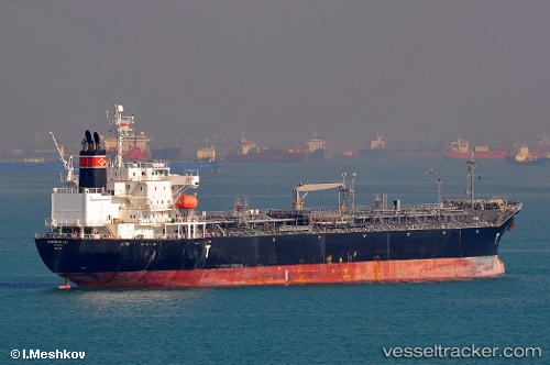
 SEA GULL
Current Status
Where is the vessel?
SEA GULL is currently in 289 nm S of Rupert's Bay, based on AIS data received less than 1h ago.
Latest AIS update:
Current position: 20.69503° S, 5.12551° W (289 nm S of Rupert's Bay)
Average speed (last 7 days): Loading…
Average speed (last 30 days): Loading…
Vessel profile: SEA GULL is a Oil/Chemical Tanker with dimensions m x m.
This page combines live AIS, route history, probable destination signals, nearby traffic, and port activity for practical vessel monitoring.
The current position of vessel SEA GULL is -20.69503 lat / -5.12551 lng. Updated: 2026-05-15 17:26:04 UTCNearest reference points:
- Open sea (no nearby ports in database)
- Open sea, approx. 401 nm off the nearest listed port
- Open sea, approx. 404 nm off the nearest listed port
Currently sailing under the flag of Liberia ![]()
Details:
Live Vessel SEA GULL Analytics (details, animations, etc.)
Recent AIS points (UTC):
2026-05-15 13:48:09 UTC · -20.32820, -5.70195 · SOG 10.9 kn · COG 123°2026-05-15 15:46:11 UTC · -20.52555, -5.39078 · SOG 10.7 kn · COG 120°
2026-05-15 16:26:23 UTC · -20.59357, -5.28626 · SOG 10.6 kn · COG 125°
2026-05-15 17:26:04 UTC · -20.69503, -5.12551 · SOG 11.1 kn · COG 127°