 vesseltracker.com
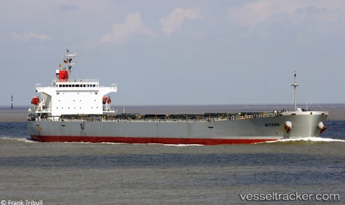
 LUCERNE
Current Status
Where is the vessel?
LUCERNE is currently in 222 nm NW of Caufield North, based on AIS data received less than 1h ago.
Latest AIS update:
Current position: 35.49955° S, 11.29444° E (222 nm NW of Caufield North)
Average speed (last 7 days): Loading…
Average speed (last 30 days): Loading…
Vessel profile: LUCERNE is a Bulk Carrier with dimensions m x m.
This page combines live AIS, route history, probable destination signals, nearby traffic, and port activity for practical vessel monitoring.
The current position of vessel LUCERNE is -35.49955 lat / 11.29444 lng. Updated: 2026-05-02 19:52:22 UTCNearest reference points:
- 271 nm NW of Caufield North
- 254 nm W of Saldanha Bay
- Open sea, approx. 402 nm off the nearest listed port
Currently sailing under the flag of Liberia ![]()
Details:
Live Vessel LUCERNE Analytics (details, animations, etc.)
Recent AIS points (UTC):
2026-05-02 16:26:02 UTC · -35.50109, 10.75951 · SOG 7.8 kn · COG 88°2026-05-02 18:17:21 UTC · -35.49864, 11.04899 · SOG 7.7 kn · COG 90°
2026-05-02 19:29:21 UTC · -35.49865, 11.23510 · SOG 7.5 kn · COG 91°
2026-05-02 19:52:22 UTC · -35.49955, 11.29444 · SOG 7.4 kn · COG 91°