 vesseltracker.com
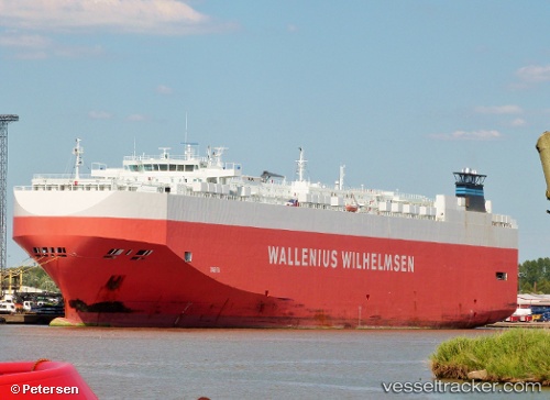
Tarifa
Current StatusWhere is the vessel?
Tarifa is currently in Near Mamonal, based on AIS data received less than 1h ago.
Latest AIS update:
Current position: 10.28939° N, 75.53532° W (Near Mamonal)
Average speed (last 7 days): Loading…
Average speed (last 30 days): Loading…
Vessel profile: Tarifa is a Vehicles Carrier with dimensions 30m x 200m.
This page combines live AIS, route history, probable destination signals, nearby traffic, and port activity for practical vessel monitoring.
The current position of vessel Tarifa is 10.28939 lat / -75.53532 lng. Updated: 2026-05-15 07:18:53 UTCNearest reference points:
- Near Contecar
- Near Sociedad Portuaria Regional Cartagena
- Near Santa Marta
Details:
Live Vessel Tarifa Analytics (details, animations, etc.)
Recent AIS points (UTC):
2026-05-15 03:57:58 UTC · 10.28940, -75.53530 · SOG 0 kn · COG 55°2026-05-15 04:12:53 UTC · 10.28940, -75.53533 · SOG 0 kn · COG 55°
2026-05-15 05:45:53 UTC · 10.28941, -75.53531 · SOG 0 kn · COG 55°
2026-05-15 07:18:53 UTC · 10.28939, -75.53532 · SOG 0 kn · COG 55°