 vesseltracker.com
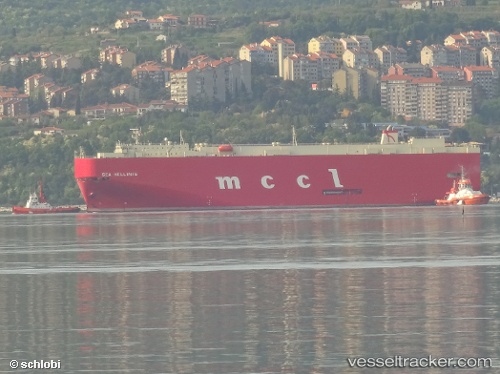
 Sea Hellinis
Current Status
Where is the vessel?
Sea Hellinis is currently in 24 nm NW of Aaiun, based on AIS data received about 2h ago.
Latest AIS update:
Current position: 27.32062° N, 13.80986° W (24 nm NW of Aaiun)
Average speed (last 7 days): Loading…
Average speed (last 30 days): Loading…
Vessel profile: Sea Hellinis is a Vehicles Carrier with dimensions 180m x 30m.
This page combines live AIS, route history, probable destination signals, nearby traffic, and port activity for practical vessel monitoring.
The current position of vessel Sea Hellinis is 27.32062 lat / -13.80986 lng. Updated: 2026-05-14 07:16:18 UTCNearest reference points:
- Near Aaiun
- Near LAS COLORADAS
- Near Lanzarote
Currently sailing under the flag of Panama ![]()
Sea Hellinis built in 2005 year
Deadweight:
14962 tDetails:
Live Vessel Sea Hellinis Analytics (details, animations, etc.)
Recent AIS points (UTC):
2026-05-14 04:04:15 UTC · 26.65415, -14.31203 · SOG 14.8 kn · COG 34°2026-05-14 06:12:57 UTC · 27.09760, -13.97437 · SOG 15 kn · COG 34°
2026-05-14 06:58:26 UTC · 27.25707, -13.85645 · SOG 15.2 kn · COG 31°
2026-05-14 07:16:18 UTC · 27.32062, -13.80986 · SOG 15.4 kn · COG 31°