 vesseltracker.com
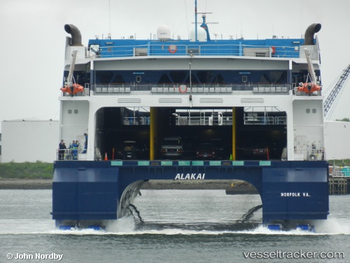
 ALAKAI
Current Status
Where is the vessel?
ALAKAI is currently in Near Yarmouth, based on AIS data received about 1h ago.
Latest AIS update:
Current position: 43.83353° N, 66.12442° W (Near Yarmouth)
Average speed (last 7 days): Loading…
Average speed (last 30 days): Loading…
Vessel profile: ALAKAI is a Passenger/Ro-Ro Ship (vehicles) with dimensions m x m.
This page combines live AIS, route history, probable destination signals, nearby traffic, and port activity for practical vessel monitoring.
The current position of vessel ALAKAI is 43.83353 lat / -66.12442 lng. Updated: 2026-05-14 11:50:05 UTCNearest reference points:
- Near Wedgeport
- Near Lower Woods Harbour
- Near Tiverton
Currently sailing under the flag of United States of America ![]()
ALAKAI built in 2007 year
Deadweight:
936 tDetails:
Live Vessel ALAKAI Analytics (details, animations, etc.)
Recent AIS points (UTC):
2026-05-14 07:38:06 UTC · 43.83354, -66.12443 · SOG 0 kn · COG 14°2026-05-14 09:44:06 UTC · 43.83353, -66.12443 · SOG 0 kn · COG 15°
2026-05-14 11:14:07 UTC · 43.83353, -66.12442 · SOG 0 kn · COG 15°
2026-05-14 11:50:05 UTC · 43.83353, -66.12442 · SOG 0 kn · COG 15°