 vesseltracker.com
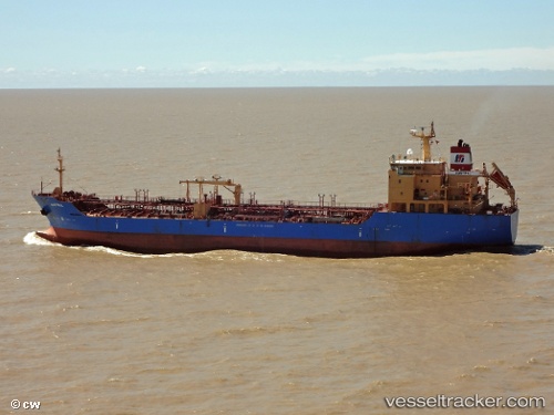
 Panarea M
Current Status
Where is the vessel?
Panarea M is currently in Near Giammoro, based on AIS data received less than 1h ago.
Latest AIS update:
Current position: 38.21670° N, 15.28415° E (Near Giammoro)
Average speed (last 7 days): Loading…
Average speed (last 30 days): Loading…
Vessel profile: Panarea M is a Chemical Oil Products Tanker with dimensions 117m x 20m.
This page combines live AIS, route history, probable destination signals, nearby traffic, and port activity for practical vessel monitoring.
The current position of vessel Panarea M is 38.21670 lat / 15.28415 lng. Updated: 2026-05-13 19:46:28 UTCNearest reference points:
- Near Milazzo
- 13 nm N of Rometta Marea
- Near TREMESTIERI
Currently sailing under the flag of Italy ![]()
Panarea M built in 2006 year
Deadweight:
11298 tDetails:
Live Vessel Panarea M Analytics (details, animations, etc.)
Recent AIS points (UTC):
2026-05-13 15:37:21 UTC · 38.29688, 15.32108 · SOG 3.4 kn · COG 290°2026-05-13 16:36:30 UTC · 38.25010, 15.32213 · SOG 9.7 kn · COG 226°
2026-05-13 17:25:30 UTC · 38.21638, 15.28393 · SOG 0.2 kn · COG 294°
2026-05-13 19:46:28 UTC · 38.21670, 15.28415 · SOG 0.2 kn · COG 278°