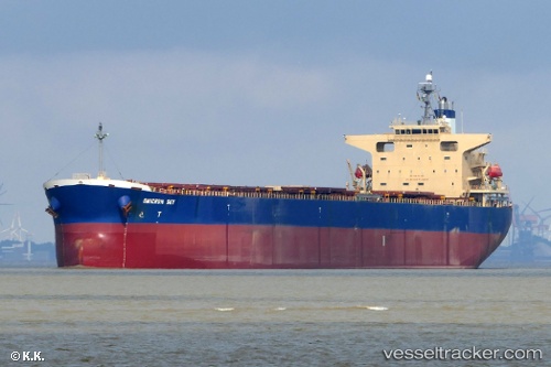
Omicron Sky
Current StatusWhere is the vessel?
Omicron Sky is currently in 218 nm S of Diego Garcia, based on AIS data received about 14h ago.
Latest AIS update:
Current position: 10.75558° S, 73.62762° E (218 nm S of Diego Garcia)
Average speed (last 7 days): Loading…
Average speed (last 30 days): Loading…
Vessel profile: Omicron Sky is a Bulk Carrier with dimensions 32m x 225m.
This page combines live AIS, route history, probable destination signals, nearby traffic, and port activity for practical vessel monitoring.
The current position of vessel Omicron Sky is -10.75558 lat / 73.62762 lng. Updated: 2026-05-23 23:32:45 UTCNearest reference points:
- 253 nm S of Diego Garcia
- 263 nm S of Diego Garcia
- Open sea, approx. 402 nm off the nearest listed port
Details:
Live Vessel Omicron Sky Analytics (details, animations, etc.)
Recent AIS points (UTC):
2026-05-23 19:40:44 UTC · -11.14803, 73.13480 · SOG 9.4 kn · COG 51°2026-05-23 22:02:08 UTC · -10.91455, 73.43813 · SOG 9.7 kn · COG -1°
2026-05-23 22:13:43 UTC · -10.89490, 73.46203 · SOG 9.6 kn · COG -1°
2026-05-23 23:32:45 UTC · -10.75558, 73.62762 · SOG 9.7 kn · COG 49°