 vesseltracker.com
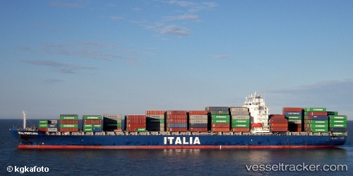
 CELSIUS NICOSIA
Current Status
Where is the vessel?
CELSIUS NICOSIA is currently in 40 nm W of Sociedad Portuaria Regional Cartagena, based on AIS data received less than 1h ago.
Latest AIS update:
Current position: 10.24557° N, 76.19719° W (40 nm W of Sociedad Portuaria Regional Cartagena)
Average speed (last 7 days): Loading…
Average speed (last 30 days): Loading…
Vessel profile: CELSIUS NICOSIA is a Container Ship with dimensions 32m x 239m.
This page combines live AIS, route history, probable destination signals, nearby traffic, and port activity for practical vessel monitoring.
The current position of vessel CELSIUS NICOSIA is 10.24557 lat / -76.19719 lng. Updated: 2026-05-14 11:13:49 UTCNearest reference points:
- Near Sociedad Portuaria Regional Cartagena
- Near Contecar
- 62 nm NE of Playón Chico
Currently sailing under the flag of Marshall Islands ![]()
CELSIUS NICOSIA built in 2007 year
Deadweight:
42969 tDetails:
Live Vessel CELSIUS NICOSIA Analytics (details, animations, etc.)
Recent AIS points (UTC):
2026-05-14 07:58:07 UTC · 10.19500, -76.75833 · SOG 10 kn · COG -1°2026-05-14 10:22:07 UTC · 10.23667, -76.34667 · SOG 10 kn · COG -1°
2026-05-14 10:25:10 UTC · 10.23667, -76.33833 · SOG 10 kn · COG -1°
2026-05-14 11:13:49 UTC · 10.24557, -76.19719 · SOG 10.3 kn · COG 87°