 vesseltracker.com
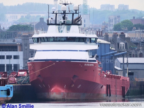
Skandi Barra
Current StatusWhere is the vessel?
Skandi Barra is currently in 27 nm N of Catterline, based on AIS data received less than 1h ago.
Latest AIS update:
Current position: 57.33333° N, 0.93167° W (27 nm N of Catterline)
Average speed (last 7 days): Loading…
Average speed (last 30 days): Loading…
Vessel profile: Skandi Barra is a Offshore Tug Supply Ship with dimensions 20m x 86m.
This page combines live AIS, route history, probable destination signals, nearby traffic, and port activity for practical vessel monitoring.
The current position of vessel Skandi Barra is 57.33333 lat / -0.93167 lng. Updated: 2026-05-14 03:14:11 UTCNearest reference points:
- Near Peterhead
- Near PETERHEAD
- Near Aberdeen
Details:
Live Vessel Skandi Barra Analytics (details, animations, etc.)
Recent AIS points (UTC):
2026-05-13 23:30:37 UTC · 57.13980, -2.08532 · SOG 0 kn · COG 270°2026-05-14 01:37:47 UTC · 57.23107, -1.57195 · SOG 13.4 kn · COG 76°
2026-05-14 01:53:07 UTC · 57.24647, -1.47030 · SOG 13.5 kn · COG 75°
2026-05-14 03:14:11 UTC · 57.33333, -0.93167 · SOG 13 kn · COG -1°