 vesseltracker.com
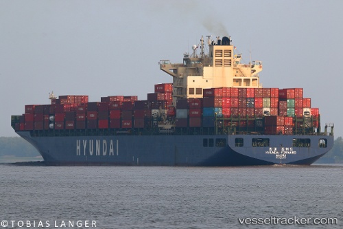
Hyundai Forward
Current StatusWhere is the vessel?
Hyundai Forward is currently in 44 nm SE of Lü-hua Shan, based on AIS data received less than 1h ago.
Latest AIS update:
Current position: 30.27543° N, 123.17773° E (44 nm SE of Lü-hua Shan)
Average speed (last 7 days): Loading…
Average speed (last 30 days): Loading…
Vessel profile: Hyundai Forward is a Container Ship with dimensions 32m x 295m.
This page combines live AIS, route history, probable destination signals, nearby traffic, and port activity for practical vessel monitoring.
The current position of vessel Hyundai Forward is 30.27543 lat / 123.17773 lng. Updated: 2026-05-14 15:46:28 UTCNearest reference points:
- 43 nm E of JINHAI HEAVY INDUSTR
- 50 nm SE of Lü-hua Shan
- 37 nm SE of Lü-hua Shan
Details:
Live Vessel Hyundai Forward Analytics (details, animations, etc.)
Recent AIS points (UTC):
2026-05-14 11:59:09 UTC · 29.66988, 122.82073 · SOG 11.9 kn · COG 88°2026-05-14 13:09:48 UTC · 29.88298, 122.93293 · SOG 13.5 kn · COG 15°
2026-05-14 14:03:58 UTC · 30.08157, 122.99728 · SOG 13.4 kn · COG 19°
2026-05-14 15:46:28 UTC · 30.27543, 123.17773 · SOG 0.3 kn · COG 202°