 vesseltracker.com
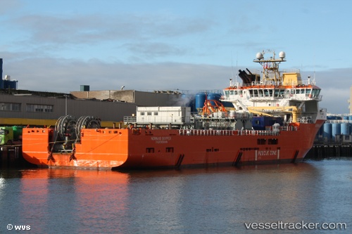
 SKIPPER TIDE
Current Status
Where is the vessel?
SKIPPER TIDE is currently in 20 nm W of Ham Voe, Foula, based on AIS data received less than 1h ago.
Latest AIS update:
Current position: 60.10833° N, 2.69333° W (20 nm W of Ham Voe, Foula)
Average speed (last 7 days): Loading…
Average speed (last 30 days): Loading…
Vessel profile: SKIPPER TIDE is a Multi Purpose Offshore Vessel with dimensions m x m.
This page combines live AIS, route history, probable destination signals, nearby traffic, and port activity for practical vessel monitoring.
The current position of vessel SKIPPER TIDE is 60.10833 lat / -2.69333 lng. Updated: 2026-05-14 15:38:39 UTCNearest reference points:
- 36 nm NW of Ham Voe, Foula
- 32 nm NW of Eshaness
- Near Tingwall
Currently sailing under the flag of United Kingdom ![]()
Details:
Live Vessel SKIPPER TIDE Analytics (details, animations, etc.)
Recent AIS points (UTC):
2026-05-14 11:34:24 UTC · 59.64786, -2.13417 · SOG 8.4 kn · COG 331°2026-05-14 13:41:22 UTC · 59.90490, -2.42115 · SOG 8 kn · COG 344°
2026-05-14 14:05:32 UTC · 59.95111, -2.46807 · SOG 8.1 kn · COG 343°
2026-05-14 15:38:39 UTC · 60.10833, -2.69333 · SOG 7 kn · COG -1°